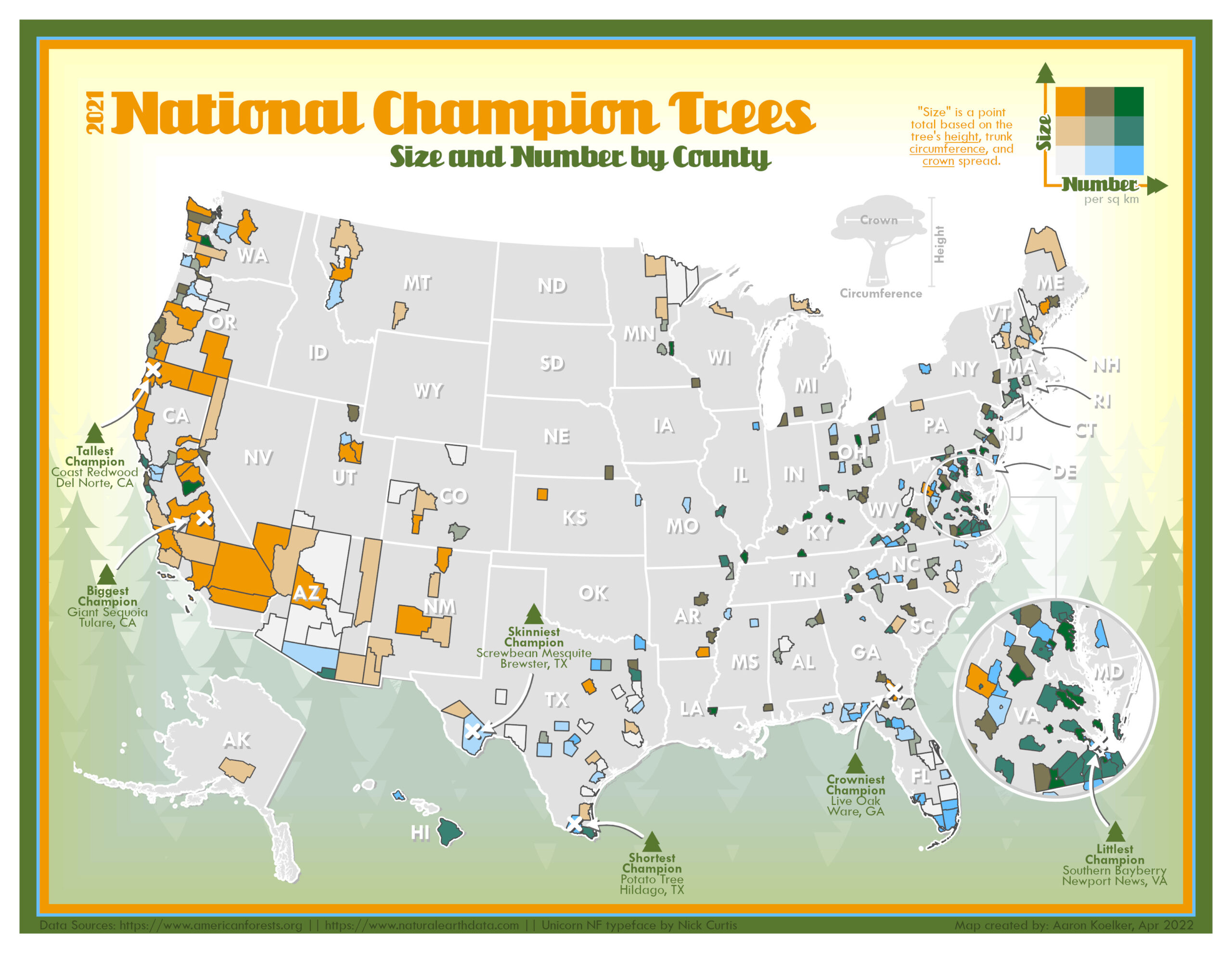
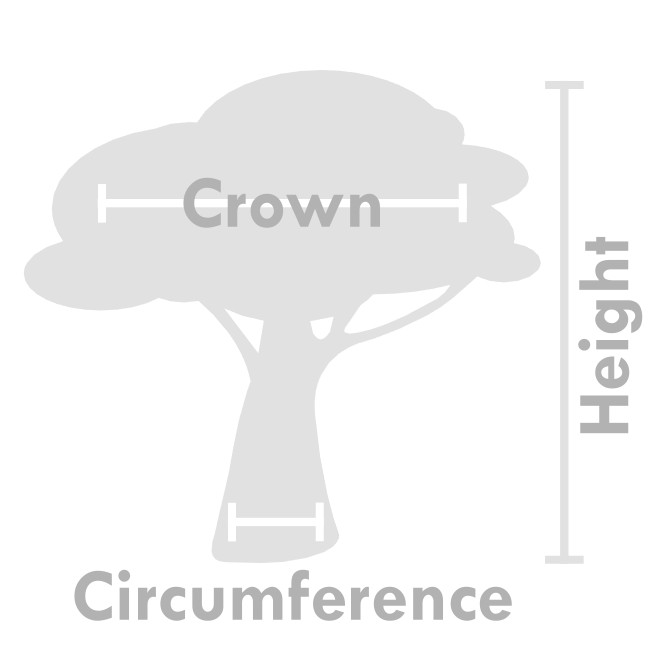
National Champion Trees are the biggest tree of a particular species based on the height, trunk circumference, and average crown spread. These trees are nominated by the public and maintained in an official register by American Forests. The 2021 list of champions features 561 trees across 39 states.
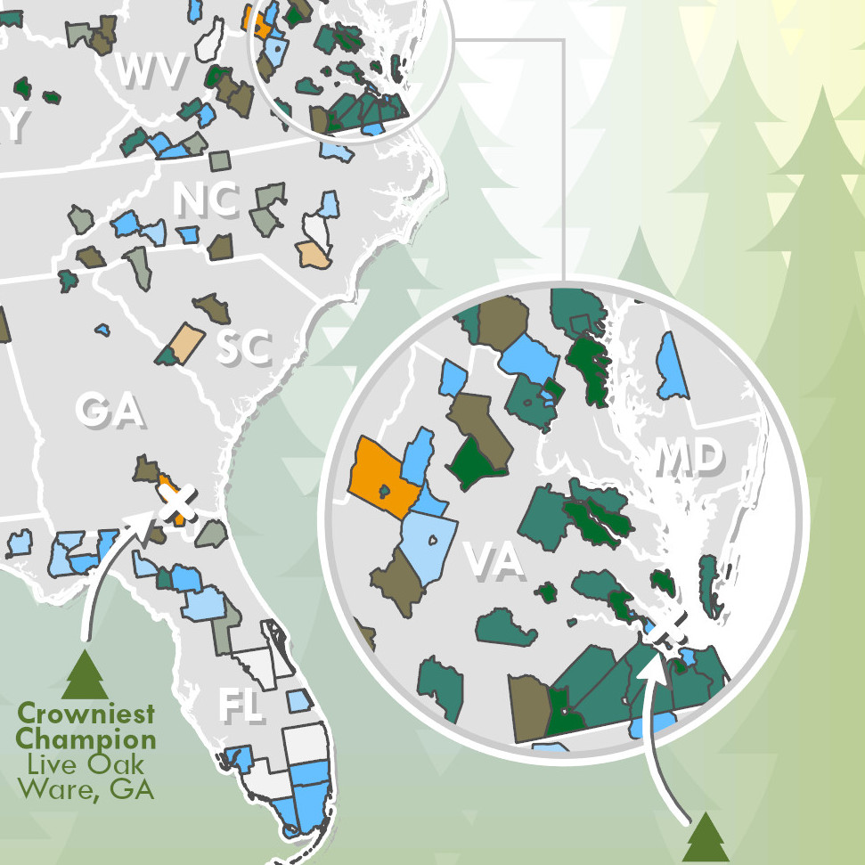
This official register is available via PDF and features tree measurements, health status, and dates for each champion, but limits location to just county and state in an effort to protect the trees from potential vandalism. Protecting these trees is important, but the secrecy makes for limited mapping options. County boundaries aren’t an ideal areal unit, so for my first attempt at making a map of these trees I wrote a simple python script that randomly generated XY coordinates for each tree within its associated county limits, while maintaining all the tree’s other attributes so that I could do some basic statistics on all the size measurements. However, the random tree points, even when clustered, didn’t make for a very visually interesting map, and so I ended up going back to using the county boundaries, despite their problems.
Counties are a good opportunity for a bivariate choropleth map, though. The one I ended up with here compares average champion “size” — which is a point total based on the height, trunk circumference, and crown spread of the tree — against the total number of trees in each county. Since county boundaries are all sorts of different sizes, I used the rate of trees per square kilometer instead of raw totals.
There are other biases in this data beyond county size, though. Regions with more forests obviously have more champions (sad North Dakota noises), and a higher tree diversity means a higher potential number of champions for the area. But what’s less obvious is the influence of the communities actually reporting the trees. Some regions, such as Virginia, have some very enthusiastic and prolific tree hunters who are finding and reporting many, many more trees than other communities. While most people might think to report an exceptionally large and prominent tree species in their community, these dedicated hobbyists are finding and measuring plants like the Southern Bayberry, the champion of which is only 14 feet tall with a 7 inch trunk. The champion potato tree in Hildago, Texas, is only 9 feet tall.
As opposed to my previous project, Map Turtles Mapped!, this one was made almost entirely with ArcGIS Pro. The only exception is the forest background and the measurement diagram, which were made with Adobe Illustrator and Inkscape. Everything else was created using only the ArcGIS Pro layout and graphics tools, including the borders, icons, arrows, gradients, and labels.