This piece was created for Daniel Huffman’s map projection trading cards project. The idea is to have a set of trading cards for carto-enthusiasts to collect and exchange at conferences, featuring the wide variety of map projections out there. The maps on the cards showcasing these projections are all designed by volunteer cartographers.
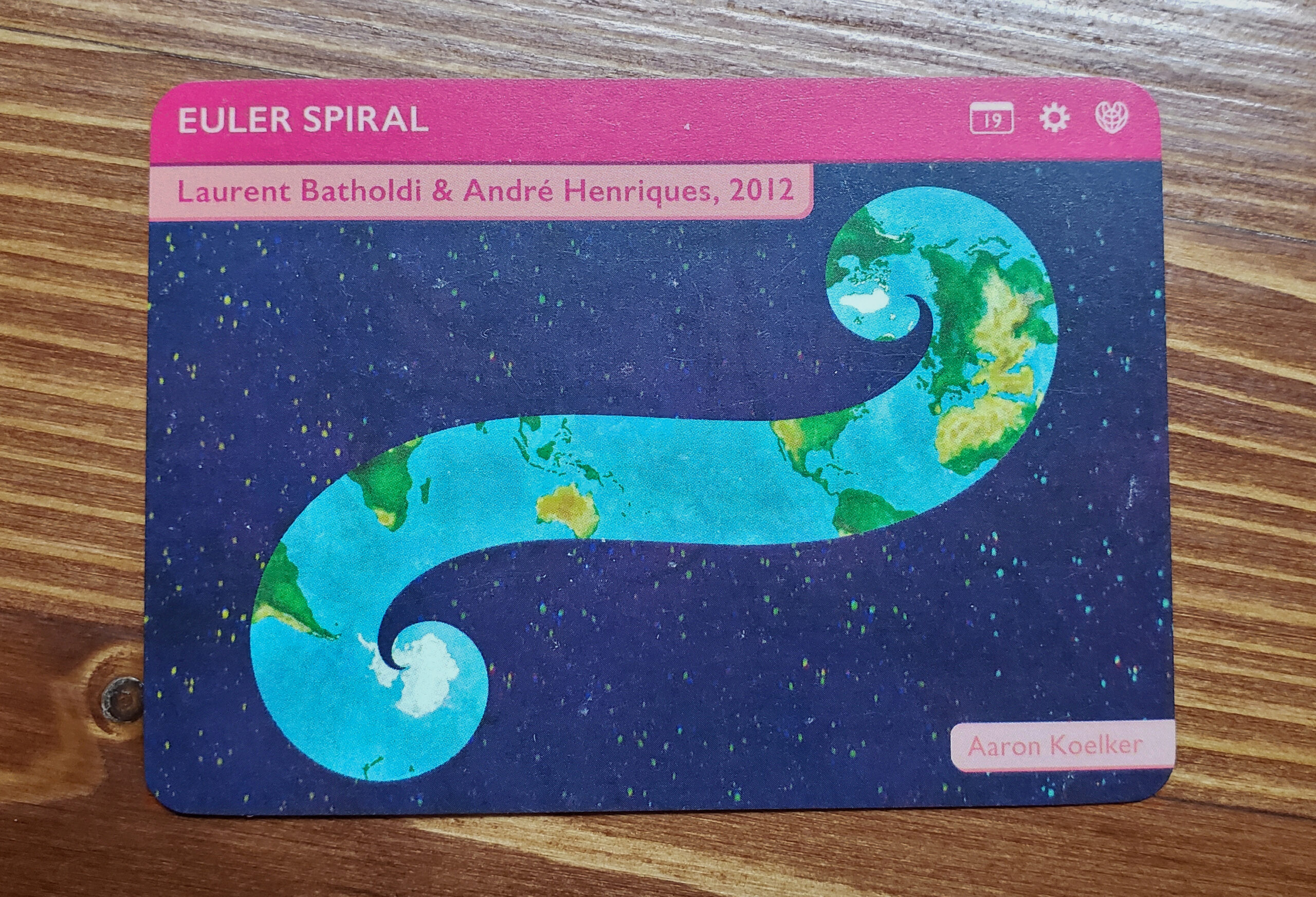
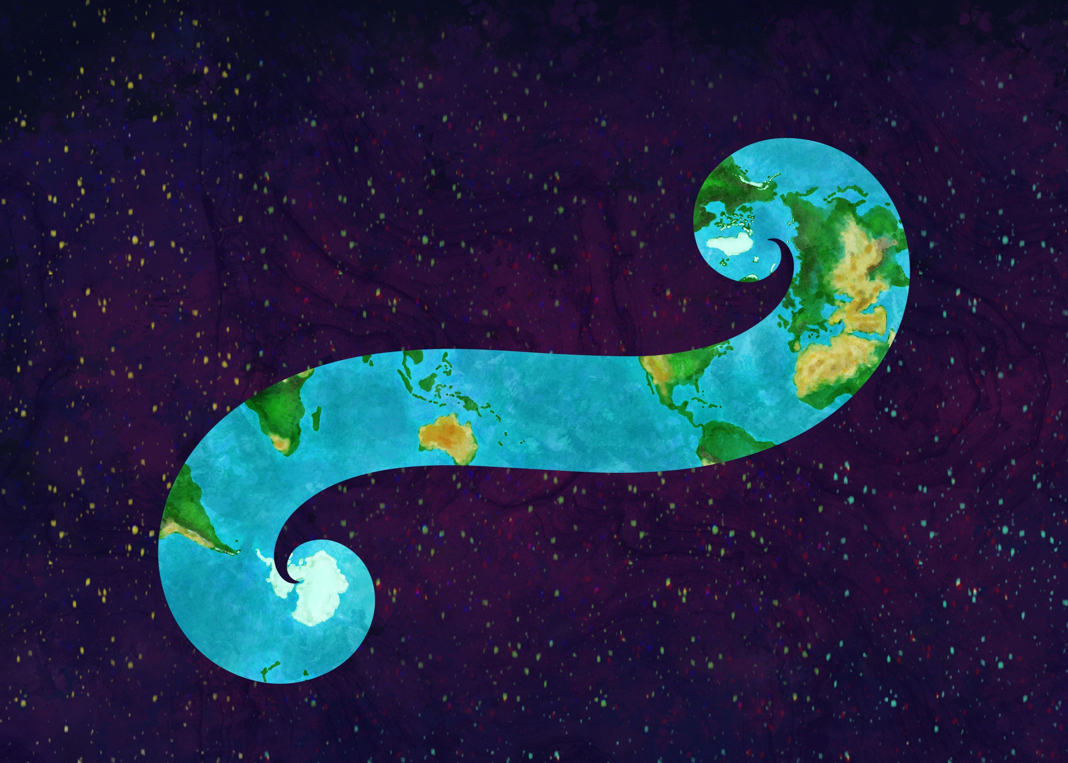
For my contribution, I chose the Euler Spiral projection — an oddball that, while interesting and fun to think about, doesn’t have much practical use for mapmaking (or so I thought!). The projection gained some popularity in a video by mathematician Hannah Fry, but (as far as I’m aware – contact me if you know otherwise), was first applied as a projection in a 2012 paper by Laurent Bartholdi and André Henriques—Orange Peels and Fresnel Integrals. (An update! David Swart features the projection in his 2009 paper—Using Turtles and Skeletons to Display the Viewable Sphere, based on a 360 photo projection that was posted by Lloyd Burchill in 2005. The plot thickens.)
An interactive version created by Anders Kaseorg helps demonstrate how a thinner slice and increasingly longer spiral translates to less and less distortion in the map, trending toward infinity and zero distortion (albeit with a completely unusable result, at that point). I am a mapmatician, not a mathematician, so I’ll take their word for it.
I drew this map by hand using Procreate. I started by using Anders Kaseorg’s interactive version above and modifying it in CodePen to utilize a basic map I made using landmasses and graticules from Natural Earth Data. With the interactive slider, I then found a relatively thick spiral that would allow for the continents to be easily recognizable on a pretty small card (3.5″ x 2.5″), and exported it. I kept one version with the landmasses and graticules for use as a visual reference of where the land should be on a spiral of this width/length, and then converted another copy to an SVG outline of just the spiral shape in Inkscape, so that I could use it as a masking layer. The copy I drew was double size (7″ x 5″). While I originally intended to include graticules, I couldn’t find a line thickness that was both easily visible and didn’t obscure too much of the landmass, so ended up omitting them