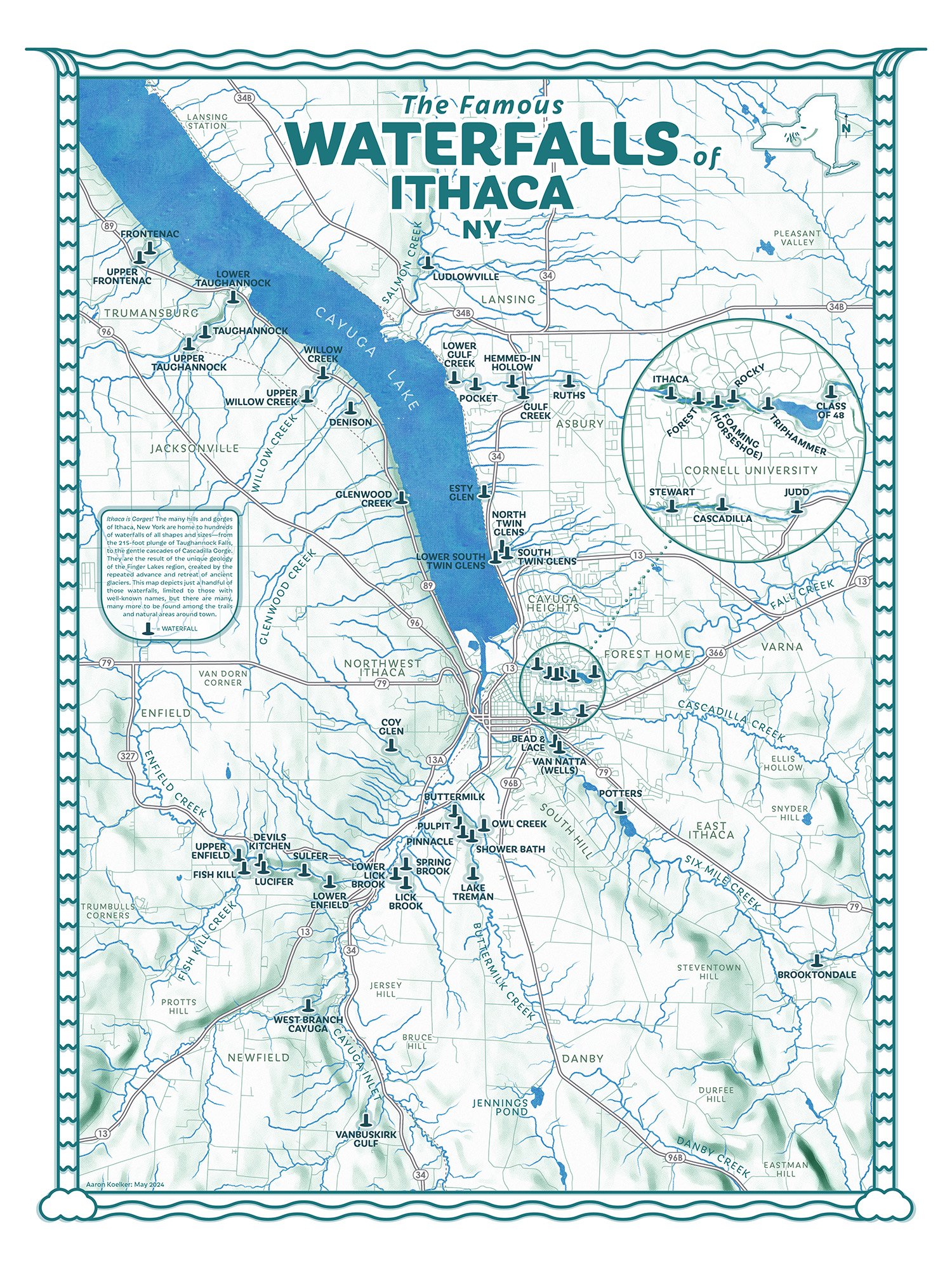
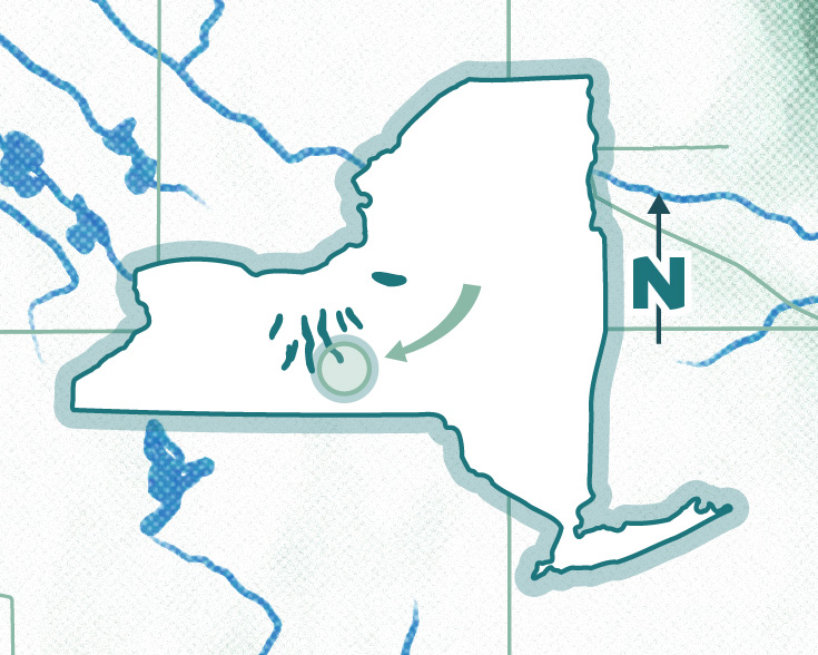
This map may forever be “in-progress”. Having recently moved from Tallahassee, Florida over to Ithaca, New York, I wanted to work on a project that could help familiarize me with the area, and settled on the idea of a comprehensive map of Ithaca’s many waterfalls. Given my experience with waterfalls in Florida—where every bit of free-falling liquid taller than six inches likely has a name, history, and surrounding park—I expected that finding data for the project would be easy. After all, Ithaca is famous for its waterfalls, and with legacy and fame usually comes names, story, and usually some sort of documentation. But after drafting a layout and filling it with points from the most robust dataset I could find (this USGS waterfall inventory), I started noticing waterfalls on my hikes or drives around town which seemed impressive to me, but weren’t appearing on my map. I’d also seen that the Ithaca visitors bureau claims there are more than 150 waterfalls within ten miles of Ithaca, yet my dataset barely had fifty. I thought that surely they wouldn’t make such a specific claim without someone having catalogued or counted them all, right?
But if Florida’s Steinhatchee Falls were located in Ithaca, folks wouldn’t even give it a second glance—it’d be less impressive than the roadside runoff following a storm, hurtling towards the lake. So while I have no doubt you could find over 150 instances of falling water around town, the vast majority are apparently not special or noteworthy enough to have a name, let alone be collected into a dataset, or have any record of their existence at all. This made the idea of a comprehensive map of all the waterfalls around town a difficult task.
My first impulse was to start designing my own data schema to begin recording these unnamed waterfalls that I found while out and about, but I realized that this project could easily become the kind of deep rabbit hole I lose months of my life to, and I’ve done too many of those lately. Instead, I was determined to keep this a “quick” project, and settle on “good enough” in some regards, for both my own sanity and maybe to better practice adhering to project scope.
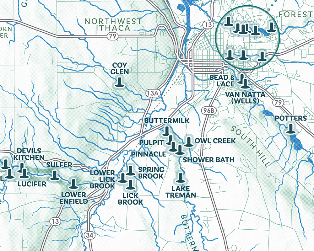
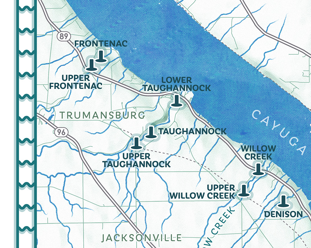
So for now, this is instead a map of the “noteworthy” or “named” waterfalls found around the city of Ithaca. And as I explore, hike, and talk to people more, I may learn or discover the names of additional waterfalls that, for whatever reason, are known to residents colloquially, but are not significant enough to find their way into the world of GIS. If you know of one, or spot an error, let me know!
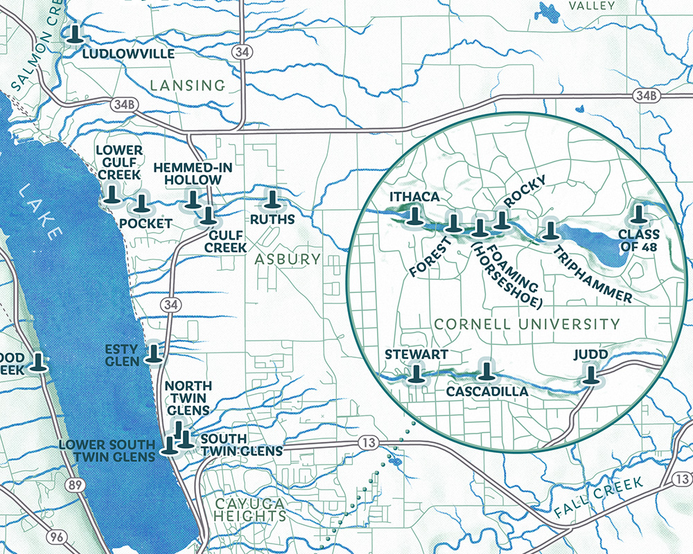
Despite the desire to be quick, I did still do a decent amount of research for this map, to find a few extra waterfalls and verify names beyond what USGS provided. And I probably will eventually start recording the location of unnamed falls I come across on my own, because there are some particularly scenic ones I’ve found that appear more significant than a few of the named ones on this map. While there doesn’t seem to be a consensus on what defines or qualifies as a waterfall—American Rivers accepts the criteria as being at least five feet high and coming from a natural river, creek, or stream that provides water at least annually. And based on my short time in Ithaca so far, that leaves me with little doubt that there are indeed hundreds to be found. It’s just that the vast abundance of them makes the average waterfall so ordinary that no one can be bothered to name them all. Only the biggest and most breathtaking, or the ones that people happen to see everyday while walking about, are bestowed a moniker. Further complicating matters are disagreements on names, or debates on whether one waterfall has multiple tiers or is actually two distinct waterfalls (Buttermilk Falls and Upper Buttermilk Falls, for example). But I digress, and I tried to ignore a lot of these questions for now, except where I was able to quickly find a clear answer.
The map itself is pretty straightforward, though I tried something new with the the terrain and water. The streams and lakes on this map were hand drawn (digitally) using the Procreate app on iPad. The difference between this and just adding a bit of digital wobble and taper to the paths in Adobe Illustrator is very subtle, and perhaps not worth the time or effort, but I do like how it came out. It also turned out to be a pretty calming exercise, as I roughly traced over and generalized vector data exported from the USGS National Hydrography Dataset. The terrain is based on 30 meter SRTM data fetched with Derek Watkin’s very handy tool, by way of NASA. I wanted to give it a bit of a soft, painterly look, and started by first generating a multidirectional hillshade. I then stretched the values between full white and this nice, blueish-green color, followed by crunching the levels a bit to cut out the top 10% of values and create more contrast between the flat and steep areas. Then I ran some Gaussian blur and a few filters over the image with Adobe Photoshop, like “Dry Brush” and “Oil Paint”, and also added a bit of artificial noise. Lastly, I applied a light halftone (or risograph) effect for even more texture, using a workflow similar to this one shared by Lucy Michelle. I then had to do all that a second time for the inset map around Cornell University, using a higher resolution DEM from the handy USGS 3DEP LiDAR Explorer.
The font is Iskra by Tom Grace, which I picked because it had a bit of a Greek flair, to acknowledge where Ithaca takes its name from. The frame is meant to look like two waterfalls.
I was a bit mean to Steinhatchee Falls earlier—Florida does have a couple of “real” waterfalls which I think stand up to those here in New York. Falling Waters State Park, for example, is a unique waterfall plunging down into one of Florida’s most infamous geological features—a very deep sinkhole.