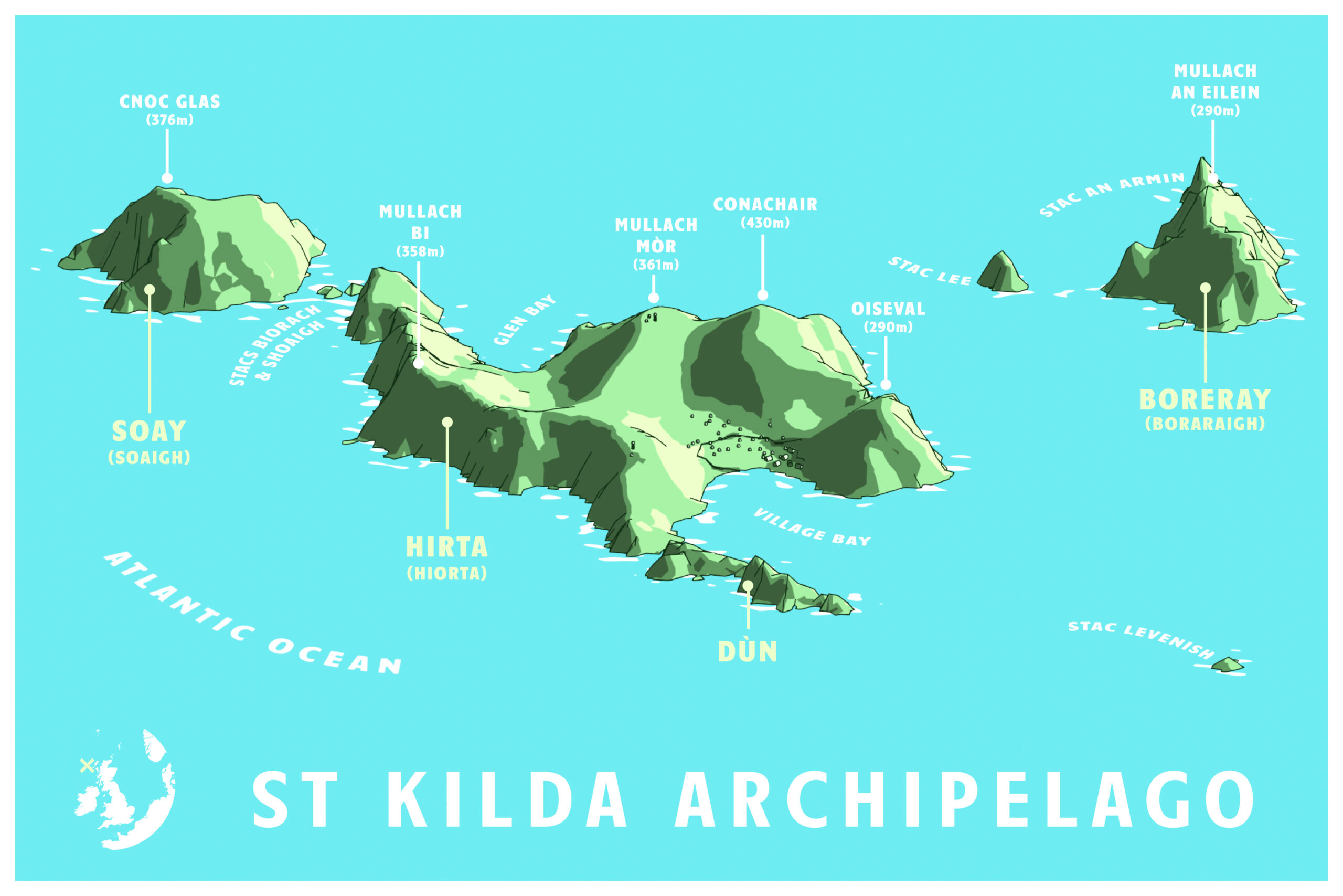
St Kilda is a small cluster of islands in the North Atlantic, located about 40 miles west of the Outer Hebrides of Scotland. The human history of these islands dates back at least two millennia, and many ancient structures can still be found there today—including prehistoric stone rings, the walls and foundations of a medieval village, and over 1400 stone storage structures called cliets that are unique to the islands. The community on the main island, Hirta, peaked in the late 17th century. In 1930, the thirty-six remaining residents of St Kilda were evacuated to the mainland after their self-sufficient life on St Kilda had become unsustainable.
Because of their isolation, the islands host a number of unique flora and fauna, including two breeds of feral sheep left over from the Neolithic era and the Iron Age, as well as the St Kilda wren. They also host a number of large seabird colonies including gannets, puffins, petrels, and fulmars—which were an important source of food for the island’s human residents.
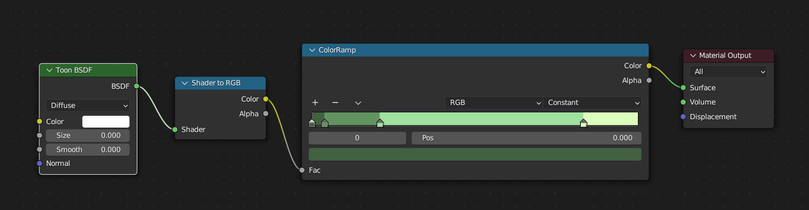
This map was mostly created with QGIS, Blender, and Adobe Illustrator. Digital elevation models were downloaded from the Scottish Remote Sensing Portal and merged within QGIS. I then performed a bit of cartographic deception and manually moved Boreray closer to the other islands using Photoshop, as in reality it is much further away and would have made it difficult for me to get all the islands in frame without a ton of blank space in between. The islands were then rendered in 3D using Blender, as I was mostly making this map as an exercise to familiarize myself with some slightly more advanced Blender workflows. Up until this point, I had used Blender mostly for designing 3D print models, but I wanted to explore some different 3D terrain visualizations for maps, and a cell-shaded style was near the top of the list. For the shader, I used a basic configuration with a ColorRamp node and the type set to Constant. The outlines were created using a Grease Pencil object and the Line Art modifier like the method shown in this tutorial by cockpitsandboobytraps, with a few extra tweaks.
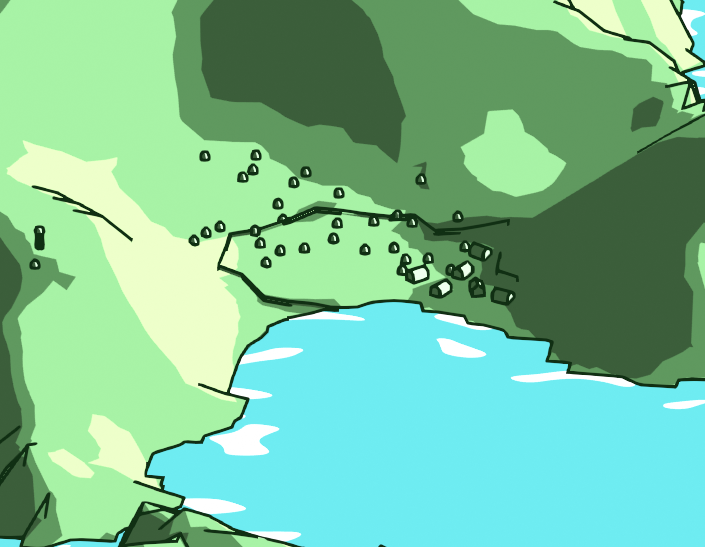
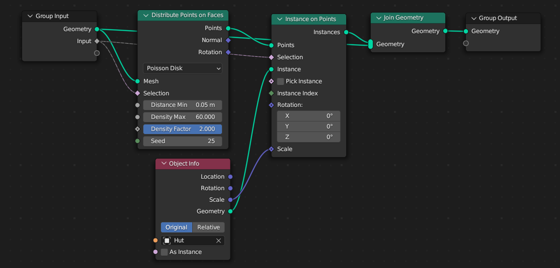
The buildings for the village on Hirta were placed using Geometry nodes. There aren’t many of them and I could have just placed them all manually, but Geometry nodes are something I’d been wanting to learn more about and this ended up being a simple introduction to them. I found this tutorial by Ryan King to be helpful in scattering the houses and cleits over the valley, and I controlled their extent using vertex groups. The tiny wall is just a simple extrusion of some edges in the mesh.
The labels were all done in Adobe Illustrator. The 3D Blender image was rendered with an orthographic (isometric) perspective, and I wanted some of the labels to match and look as if they were sitting on the surface of the water. To get them into the same perspective as the terrain, I applied a matching isometric effect using the 3D and Materials options.
This map was featured in the 2025 Geohipster calendar and on the Geohipster blog.