I started working on this spooky map in September of 2019 and was very pleased with the fact that I had so many weeks to finish it in time for Halloween. But that ended up being a naïve hope.
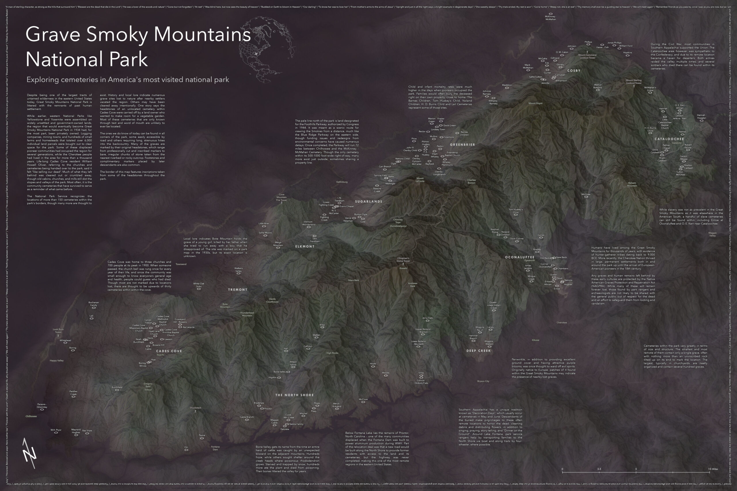
Great Smoky Mountains National Park (GSMNP) is renowned for its waterfalls, black bears, and misty mountain peaks, and we think of it and most other US National Parks as these wild, untamed places untouched by human settlement. But unlike the famous parks out west, GSMNP was assembled from more than 6000 privately-owned parcels occupied at the time by mining towns, logging companies, farmers, and pioneer settlements—some of which had been there for generations. Combined with the native Cherokee, who had lived in the region for more than a thousand years, the modern wilderness of GSMNP is littered with the remains of human settlement in a way you just don’t see in other parks of its size. Most often, it is the community cemeteries that have survived to serve as a reminder of what came before, and those became the focus of this map.
The local histories and lore left behind by these displaced communities were one of the things that most interested me about the region and inspired me to create this piece, and to help share that history with the viewer, I included a lot of those stories right on the map. I knew I wanted to use 3D to highlight the mountainous terrain and chose an isometric perspective (which preserves size and distance for everything regardless of their relation to the foreground) to keep the cemeteries furthest from the reader from getting all jumbled together or hidden behind any mountain peaks. A lot of time was spent fiddling with satellite imagery, elevation models, and color ramps to get the misty, obscured lowlands and muted tones. Then I dimmed everything outside of the park to show its extent, rather than using a traditional boundary line, which felt distracting. The Cherokee names scattered throughout remind us that the cultural history of the region did not begin with the European pioneers who left so many graves on the landscape.
I spent more time than I care to admit creating and tweaking the floating ring symbols, which come with a bit of baked-in uncertainty for each site, but what I’m most proud of is the neatline around the map’s edge. It features actual epitaphs borrowed from different headstones around the park. Some of these I collected myself on a last-minute camping trip to the park in late October, while others were gathered from online photographs and transcriptions.
This map was featured in the Atlas of Design Vol 5. Treat your bookshelf to a copy—there are many more maps amazing maps within! It also was recognized with several awards at the 2020 ESRI User Conference, including ‘Best Cartography’, ‘Cartography Special Interest Group Excellence, and 2nd place within the Reference Map category.