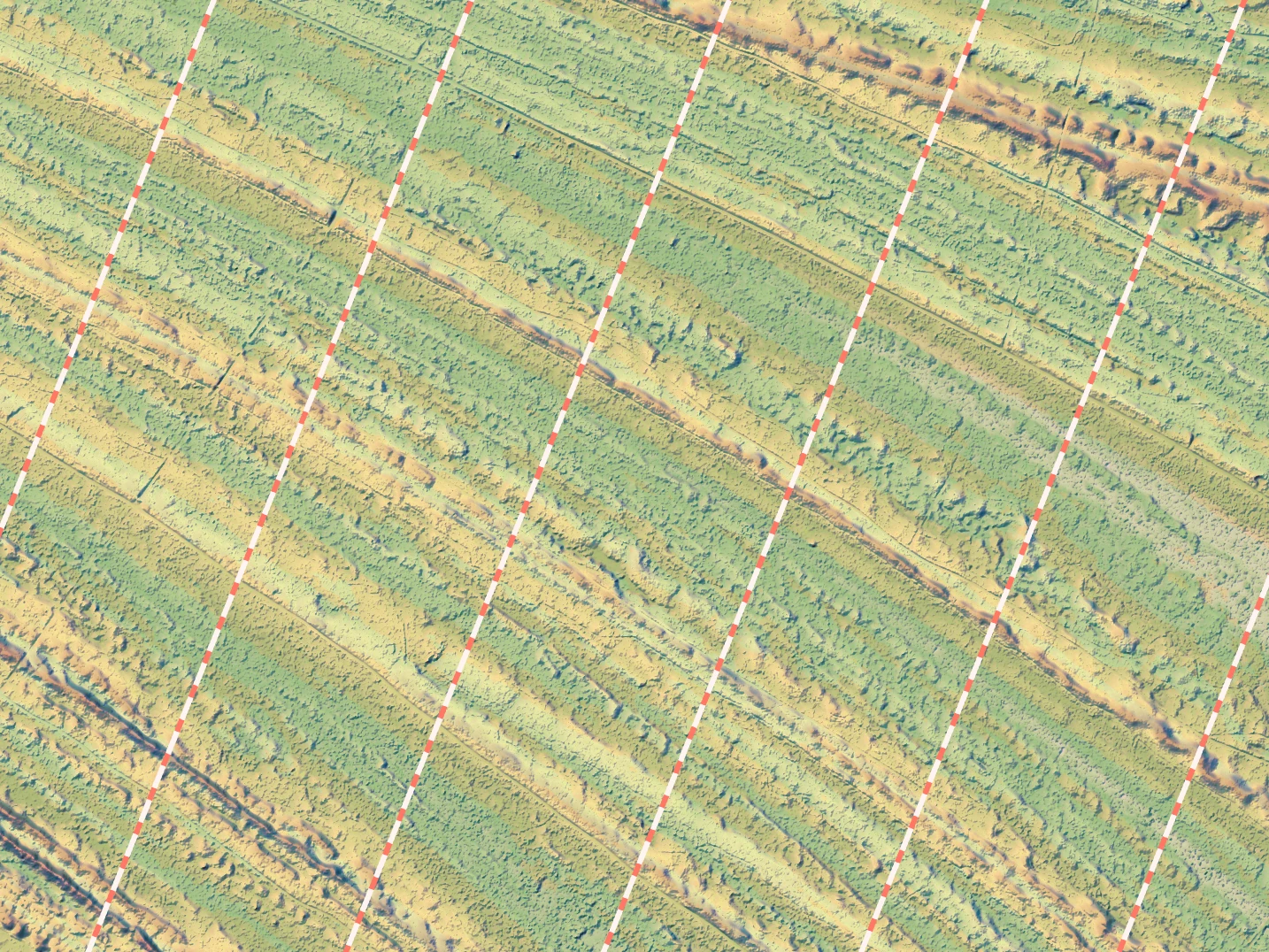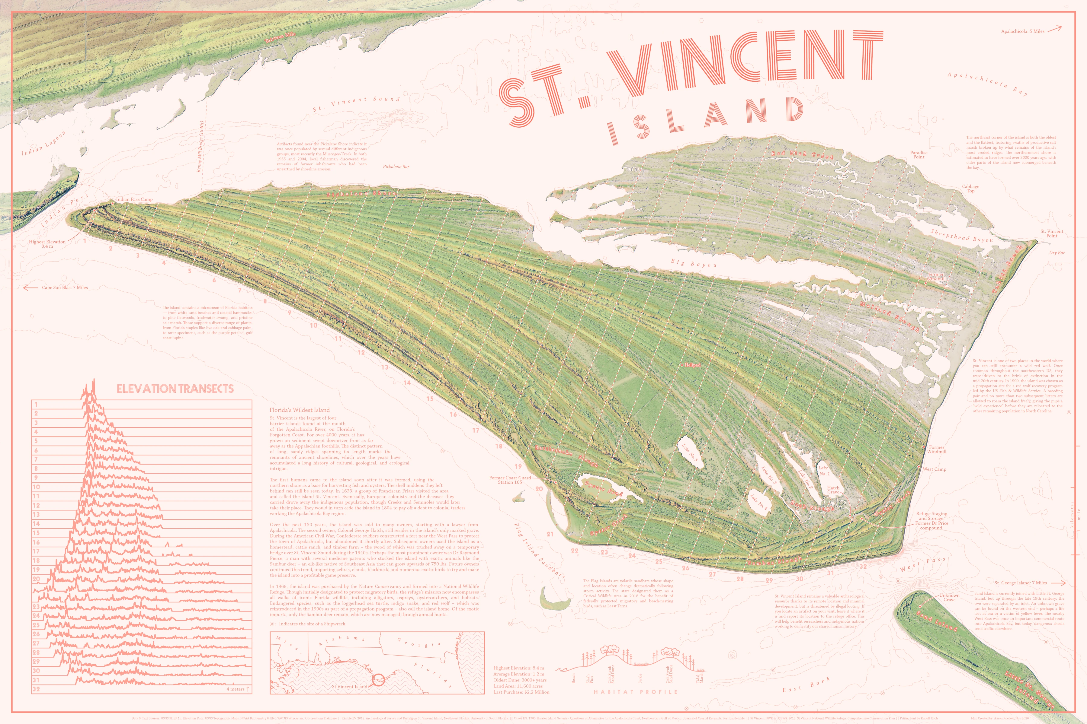
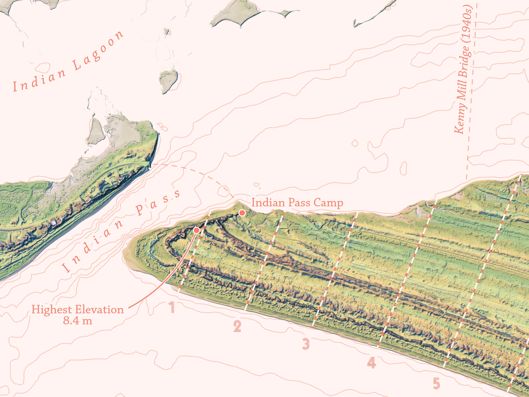
I have never actually set foot on St. Vincent Island, but it’s sandwiched between a lot of places I love and close enough to home that whenever I open up a web map I can usually see it sitting there, just on the periphery. The stark ridges crossing the island from end to end are fairly eye-catching, and I’ve wasted more time than I care to admit zooming in and around the island, combing over patterns, and forgetting about whatever I was actually trying to look up. I’ve made a couple half-hearted attempts to map it out in the past, but could never get the feel right. The ridges and never quite popped enough. So while I partly made this map to sate my own curiosity of the place, it was also a bit of a personal challenge to try and work with topography that, while interesting, was very, very flat overall. The highest point on the island is a sand dune only 8.4 meters above sea level, which itself is an outlier. The average elevation of the island is 1.2 meters. Much of it is swamp and salt marsh.
Along the way I was reading more and more about the island, and learned that it has a pretty fascinating human history to go along with its natural appeal. So the goal of my map quickly went from “how do I share the cool appearance of this island” to “how do I share this very cool island?”. Native settlements, short-lived fortresses, and free-roaming zebras all made an appearance here.
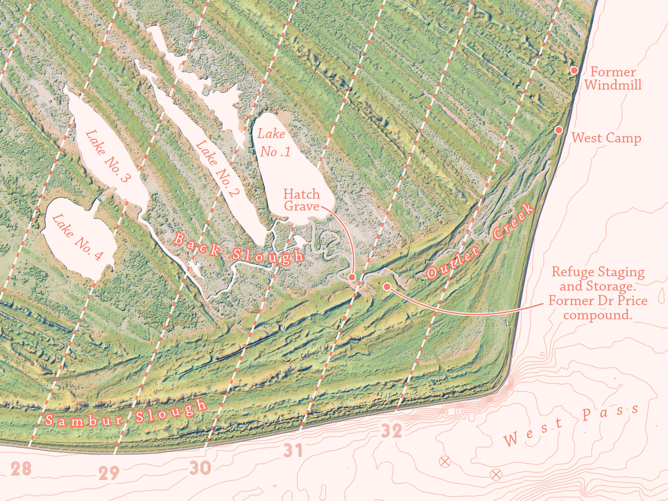
I put a lot of that neat history right onto the map in the form of flavor text, but there’s enough of it to maybe warrant a separate StoryMap or post.
A lot of work I spent on this project never made it into the map, as I spent a bunch of time in the beginning just experimenting with different ways of highlighting the island’s ridges. Prior iterations used a Blender render and a sort of abstract, oil paint style — which I do think had a lot of potential — but neither were right for this project. In the end, I settled for a combination of hypsometric tints, hillshades, and slope rasters. At this scale, the one-meter resolution lidar data I had could be considered overkill, but here I think it helps tease out the tiny creeks and drainage channels in the salt marsh. Then, generalizing that same data and adding colors to areas of a particular slope helps highlight the broader ridges stretching across the island, which otherwise might have been lost in all the noise of the original resolution.
I then created transects across the island to provide an alternate view of the topography. Despite the interesting pattern, the island is still just so flat, which makes it a challenge to create relief for. Or at least, relief that gives the viewer an accurate idea of what it would be like to stand there. But that could be said for most of coastal Florida, and I’m looking forward to working on the problem more in future maps. How do you make salt marsh and sand dunes as visually interesting and distinct as hills, canyons, mountains? A shoutout does go to Carl Churchill for this part, with his blog post on enhancing lowland terrains. This provided a lot of food for thought on tackling the problem of mapping low relief.
The mostly pink and green color scheme for the map is something I’ve been wanting to try for a while now, and I’m very happy with the Prisma typeface I settled on for the larger text, created by Rudolf Koch. The idea was to accentuate the theme of long lines. I also spent a lot of time researching place names, and referenced as many historical maps of the area as I could find to help fill it with detail. Names like ‘Sambur Slough’ appear to have been phased out of more modern maps, though nothing new has replaced them. Other features, like ‘Oyster Creek’, have several different names depending on where and when you look. The ‘Pickalene Shore’ had three or four different spellings out there from valid sources, so I went with the one I saw most often.
The entire chain of barrier islands found at the mouth of the Apalachicola River (St Vincent, Little St George, St George, and Dog Island) each have a pretty fascinating history. Perhaps I will do the other three in a similar style for a complete series.
This map won 3rd place in the Reference Map category at the 2021 ESRI User Conference.