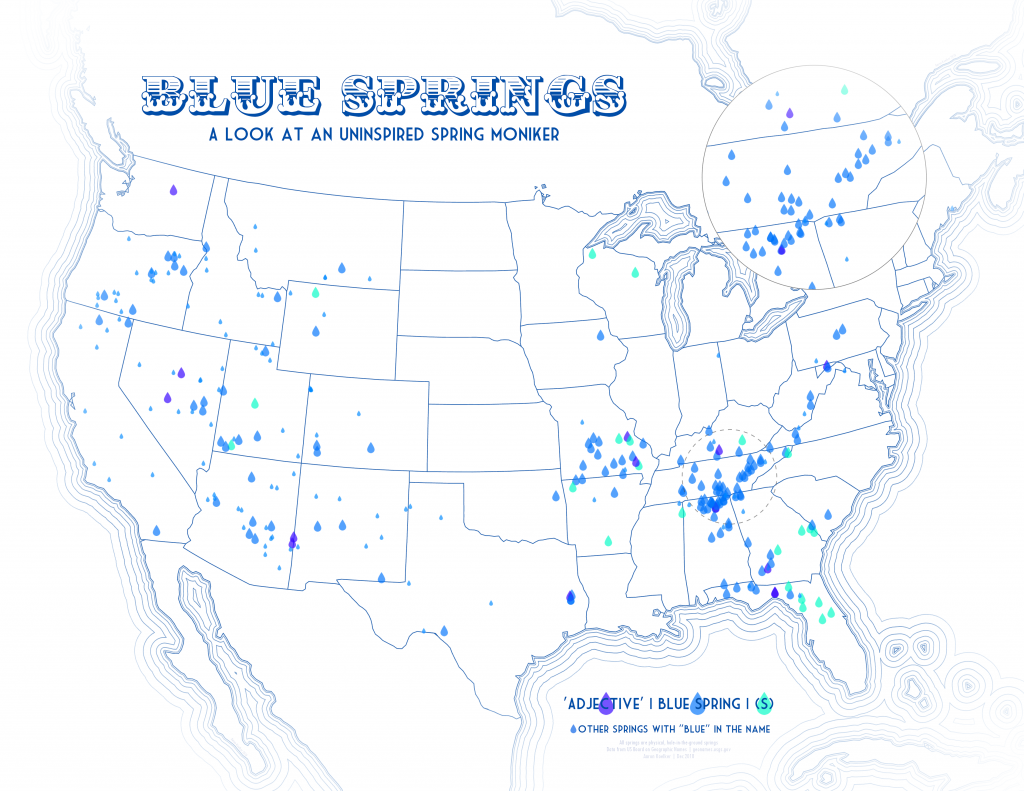
Growing up in Florida, I used to think it was weird how many different “Blue Springs” we had. One one hand, it could be confusing. On the other, it always felt like such an uninspired name for one of the state’s most iconic attractions. They’re all blue. Water is wet. Thinking on this years later, I wanted to find out if this was a uniquely-Florida problem or if other states were equally uninventive in their nomenclature. Using data from the US Board on Geographic Names, the resulting map here depicts all of the physical, hole-in-the-ground spring locations (293) in the continental US that have the name ‘Blue Spring’ (singular), ‘Blue Springs’ (plural), or ‘Something Blue Spring(s)’—in addition to any other spring with the word ‘blue’ in its name, like “Blue River Springs”. As you can see, Florida is not even the biggest offender.
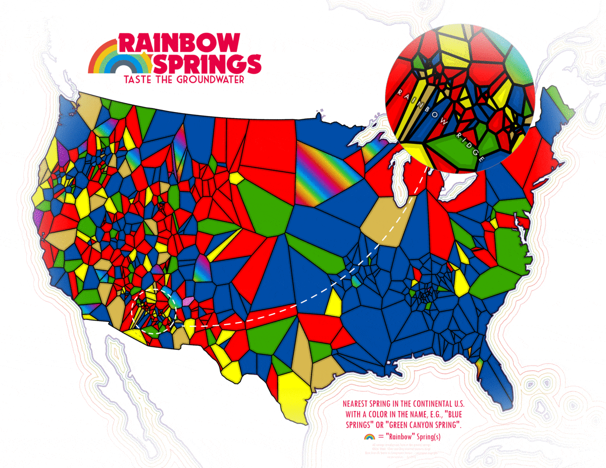
That made me curious if blue was even the most-used color in spring names, so I went back to the USGS data and filtered for any spring that had a common color in the name. I ended up excluding white, black, silver and grey from the final map because, frankly, they were sort of ugly amongst all the other colors and at this point I was committed to the idea of a cheery rainbow-themed map. Much later, I returned to the project after admiring some stained glass windows and thought it would be neat to calculate Thiessen (Voronoi) polygons around each spring, showing which spring color was nearest to what. While it’s mostly just amusing to look at and ultimately probably doesn’t mean much, I do think that the concentration of blue springs in the southeast and the increased occurrence of red springs out west is a bit curious. Predominant soil and rock colors would be my first guess, but then there’s that famous red Georgia clay that’s entirely unrepresented. I put both versions of the multicolor map into a single GIF for easy side-by-side comparison.